
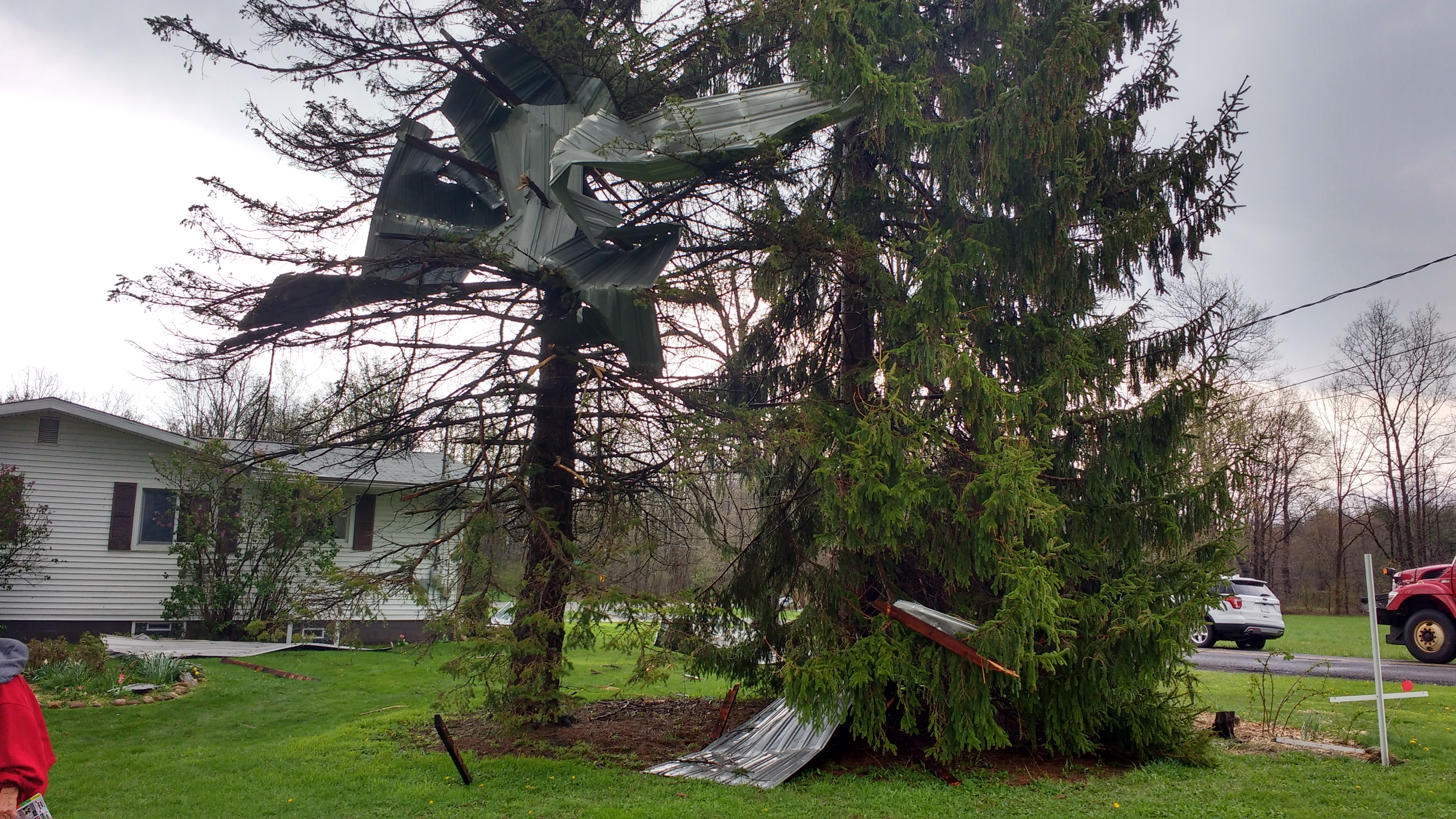
Straight Line Wind Damage
Severe weather doesn't only mean tornado's.
Microbursts
Here's some of what the National Weather Service has to say:
"A microburst is a localized column of sinking air (downdraft) within a thunderstorm and is usually less than or equal to 2.5 miles in diameter. Microbursts can cause extensive damage at the surface, and in some instances, can be life-threatening. There are two primary types of microbursts: 1) wet microbursts and 2) dry microbursts. Wet microbursts are accompanied by significant precipitation and are common in the Southeast during the summer months. It all starts with the development of a thunderstorm and the water droplets/hailstones being suspended within the updraft. Sometimes an updraft is so strong it suspends large amounts of these droplets and hailstones in the upper portions of the thunderstorm. There are many factors that can lead to evaporational cooling (sinking air) and therefore weakening of the updraft. Once this occurs, it is no longer capable of holding the large core of rain/hail up in the thunderstorm. As a result, the core plummets to the ground. As it hits the ground it spreads out in all directions. The location in which the microburst first hits the ground experiences the highest winds and greatest damage. Wind speeds in microbursts can reach up to 100 mph, or even higher, which is equivalent to an EF-1 tornado! Winds this high can cause major damage to homes and other structures and level hundreds of trees."
You can learn more at https://www.weather.gov/bmx/outreach_microbursts
Straight Line Winds
The National Oceanic & Atmospheric Administration's (NOAA) National Severe Storms Laboratory (NSSL) says:
"Damaging winds are often called “straight-line” winds to differentiate the damage they cause from tornado damage. Strong thunderstorm winds can come from a number of different processes. Most thunderstorm winds that cause damage at the ground are a result of outflow generated by a thunderstorm downdraft. Damaging winds are classified as those exceeding 50-60 mph. Damage from severe thunderstorm winds account for half of all severe reports in the lower 48 states and is more common than damage from tornadoes. Wind speeds can reach up to 100 mph and can produce a damage path extending for hundreds of miles."
You can learn more at https://www.nssl.noaa.gov/education/svrwx101/wind/
Any of these (and more) severe weather events can impact your home, business, and overall community. It's important to pay close attention to weather warnings/watches/advisories for current information. There are several ways for get notifications such as the FEMA App or a NOAA Radio. To learn more about staying prepared visit https://www.ready.gov/